Mystery PBM wrecks, Truk Lagoon. Solved.
Fri Nov 09, 2007 3:02 am
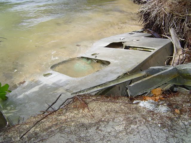
The wreck of this PBM sits on the South West side of Weno (Moen) Island in Truk Lagoon. The I was told was that the aircraft broke loose of its mooring during a storm sometime after WWII, and was dashed upon the reef. I am not aware of any PBM's being lost at Truk during the war, so I am inclined to believe this this story.
When I visited this site, I was led by a guy from the village I was living in. He told me that he was related to the landowner. This turned out to be a lie, and the entire time we were there we had to be careful not to get caught.
I have seen photos of this aircraft in the past. At one time the nose was one piece, sitting about 50' from the shore. Unfortunately I don't have a copy to show you all for reference.
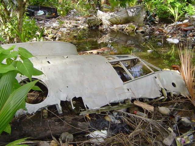
Cockpit section. About 10' from the shore.
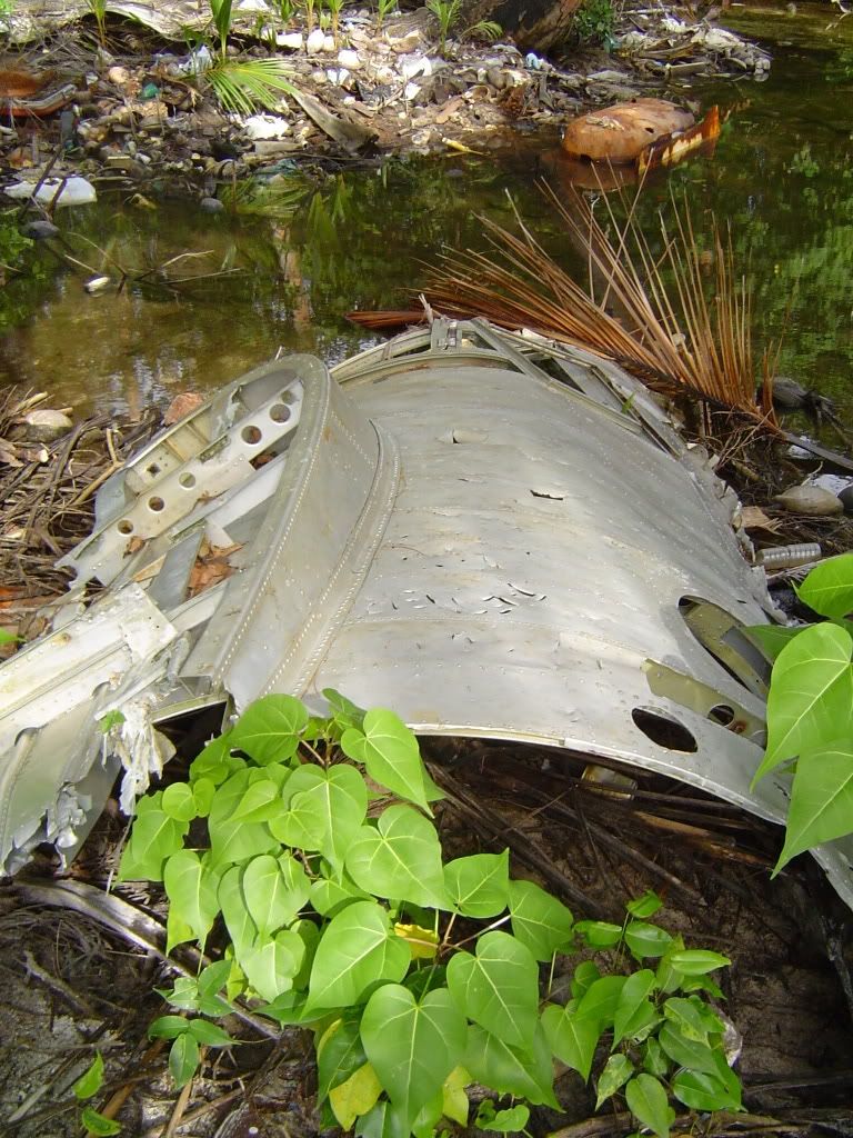
Another section is across the pond from the cockpit. These ponds are often the remains of bomb craters. Unfortunately I was unable to get close to it, for it lies near to the landowners house and I didn't pay to see the airplane.
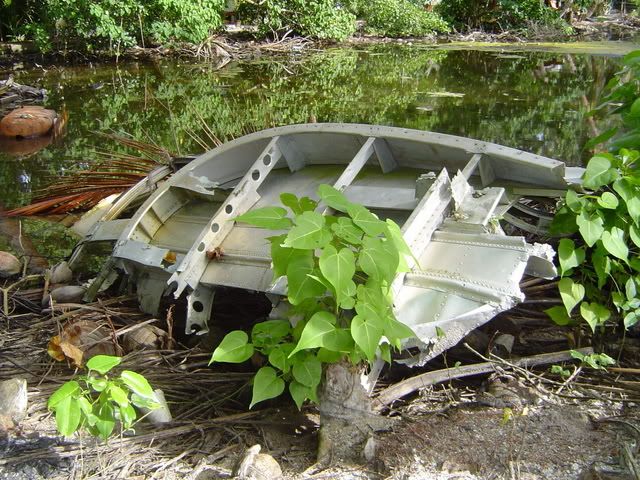
Forward fuselage?
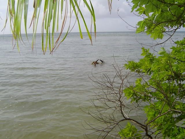
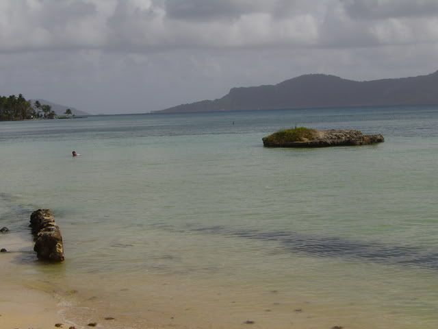
This section is about 50' off shore. It is possibly the front turret because of the rusted steel.
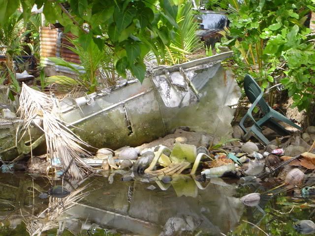
So the aircraft nose section which was once one piece is now four distinct sections. Most likely this is a result of human intervention. The parts are now separated by several yards each, and are stored around the landowners’ yard. The whole place looks like a dump. Most likely the landowner cut up the nose and hauled it onto his property so he could charge people to look at it.
In this area of the world landownership doesn't end at the shoreline. It can extend past the reef. For this reason, I was unable to dive the area in search of the rest of the aircraft.
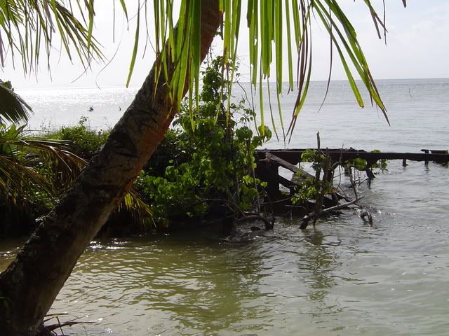
Oil Barge wreck near PBM (Japanese, U.S. ?)
Japanese Pillbox south of PBM.
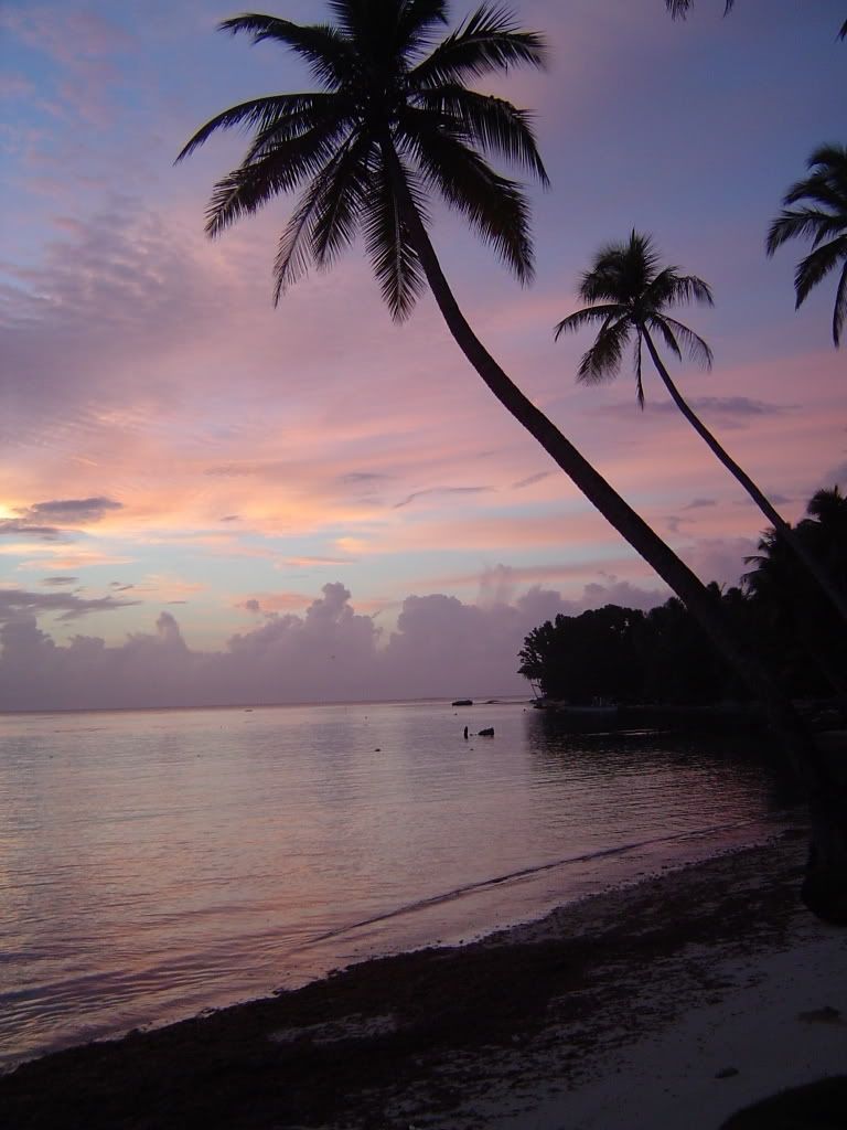
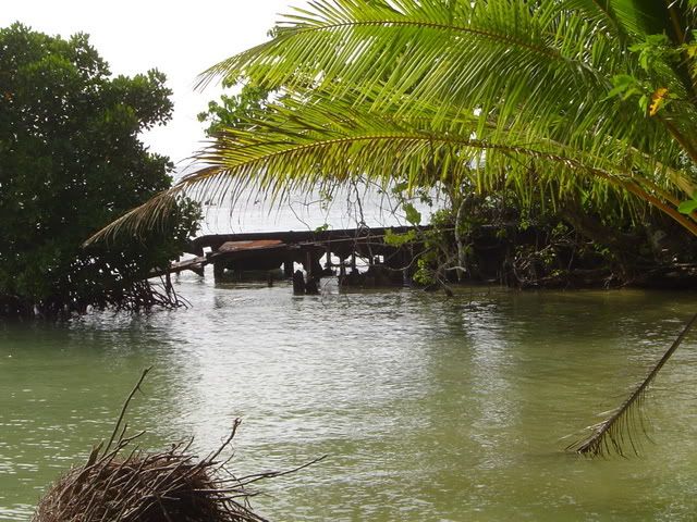
Just because it's flip'n gorgeous.
So who can help identify this mystery PBM?
When I visited this site, I was led by a guy from the village I was living in. He told me that he was related to the landowner. This turned out to be a lie, and the entire time we were there we had to be careful not to get caught.
I have seen photos of this aircraft in the past. At one time the nose was one piece, sitting about 50' from the shore. Unfortunately I don't have a copy to show you all for reference.
Cockpit section. About 10' from the shore.
Another section is across the pond from the cockpit. These ponds are often the remains of bomb craters. Unfortunately I was unable to get close to it, for it lies near to the landowners house and I didn't pay to see the airplane.
Forward fuselage?
This section is about 50' off shore. It is possibly the front turret because of the rusted steel.
So the aircraft nose section which was once one piece is now four distinct sections. Most likely this is a result of human intervention. The parts are now separated by several yards each, and are stored around the landowners’ yard. The whole place looks like a dump. Most likely the landowner cut up the nose and hauled it onto his property so he could charge people to look at it.
In this area of the world landownership doesn't end at the shoreline. It can extend past the reef. For this reason, I was unable to dive the area in search of the rest of the aircraft.
Oil Barge wreck near PBM (Japanese, U.S. ?)
Japanese Pillbox south of PBM.
Just because it's flip'n gorgeous.
So who can help identify this mystery PBM?
Last edited by Curtis Block on Sun Oct 12, 2008 12:00 am, edited 3 times in total.
Fri Nov 09, 2007 3:46 am
i think there were pics of this airplane in a issue of national geographic.
Re: Mystery PBM Truk Lagoon
Fri Nov 09, 2007 3:49 am
Curtis Block wrote:The I was told was that the aircraft broke loose of its mooring during a storm sometime after WWII, and was dashed upon the reef. I am not aware of any PBM's being lost at Truk during the war, so I am inclined to believe this this story.
As it's clearly an ocean depositing area, given the rubbish, that adds some credence as well?
Curtis Block wrote:So who can help identify this mystery PBM?
This one?
http://www.warbirdz.net/phpBB2/showthre ... ht=mariner
http://www.warbirdz.net/largepic.php?ID=10952
"Comments: Post WWII wreck of a PBM at Dublon Island. Locals informed me of a second PBM wreck in the area but could not locate."
PBMs
Fri Nov 09, 2007 6:35 am
I think we're looking at two different cockpits. Look at the two holes I've pointed out here:

Now look at the same areas on the other one:

No holes. Looks like this may be the "other" one mentioned.
Now look at the same areas on the other one:
No holes. Looks like this may be the "other" one mentioned.
Fri Nov 09, 2007 7:30 am
You go this far whats a couple more bucks to the landowner to dive the wreck?
Fri Nov 09, 2007 9:01 am
is the hull buried in the sand?? or cut off for scrap???? that's alot of hull missing!!
Fri Nov 09, 2007 4:55 pm
This looks like a garbage dump with all the trash lying around.
Sat Nov 10, 2007 7:05 pm
Hi Curtis,
I'd like to hear some more about your wreck hunting. I have a PBY friend Stan Strazza in Vancouver who's an avid wreck hunter. He frequents the BC coast.
Canso42
I'd like to hear some more about your wreck hunting. I have a PBY friend Stan Strazza in Vancouver who's an avid wreck hunter. He frequents the BC coast.
Canso42
Sat Nov 10, 2007 7:23 pm
Pat Carry wrote:This looks like a garbage dump with all the trash lying around.
Which is probably why the airplane trash is there as well - it looks like it's downstream or an eddy, where the rubbish ends up.
Sun Nov 11, 2007 5:53 pm
Sorry it took so long to get back. I'm in the middle of moving and have been very busy.
The reason the place looks like a garbage dump is the owner. It is not uncommon for people to just dump their trash sit around the property. I would have to say garbage is a big problem out there. Yes this place was bad, I did however see worse. I can't remember how many caves or bunkers I came across that were piled high with trash.
I figure that the majority of the wreckage is still some place in the water. For many years this nose section sat intact just off shore. The property owner most likely cut up what was reachable and drug the now smaller and more manageable pieces closer to his house. Some of the part at the shoreline might be buried, but I doubt that much is. Anything he hauled in had to be manageable by a couple of people.
I would have liked to make a dive on the site, but I would have also liked to make numerous other dives that just didn't work out. At the time I was concentrating my efforts on identifying / documenting more significant aircraft such as the "Claude" and the "Myrt." I was also working on trying to locate American combat losses in the area. I had a few undocumented leads but permission was never received to check out any of the sites. Heck I never even got to dive the "Emily."
A big issue out there has become the idea that the property owner is also the owner of any relics on the property. At one time it was common for the dive shops to lead land tours to the various sites on the islands. Now however the landowner expects to be paid any an amount of money they think they can get out of you. This can lead to some very uncomfortable situations. On more than a few occasions I was brought to a site and confronted by a man brandishing a machete demanding money. It feels a lot like being robbed. For this reason the companies have for the most part discontinued land tours.
During one brain storm with the Historic Preservation Office, we discussed the idea of producing somewhat of a pass that could be bought by visitors for a set price. This pass could then be used to gain access to any of the land sites covered. Landowners with historic sites would be required to register them with the HPO to have them includes in the sites covered. The HPO would then grade the sites on aspects such as size, importance, accessibility, visitor numbers and upkeep among other aspects. Money collected for the passes would then be distributed to the various landowners at regular intervals with the amount based on their grade. A system like this would have many benefits. First off, visitors would only be robbed once and landowners would still get paid. Visiting sites would become safer and more enjoyable. I would venture to guess that more sites would be documented as landowners try to get a share of the money. Landowners not maintaining their site to a certain standard could also risk being removed from the list and therefore not receive any money. Unfortunately even though it sounded like a win win proposition, I do not think any such system has been put in place as of yet.
The aircraft shown in the link is most likely not the same aircraft. The aircraft I photographed is most certainly on Moen (Weno). I am going to try to contact the person who posted that picture in order to get more information.
I was wondering if it would be possible to find the BuNo of these aircraft. Can anyone identify the models?
Fri Nov 16, 2007 2:08 am
Well I've still been working on this a little in my very rare, spare time.
I finally found contact information to John Voss, who posted the photo of the other PBM on many sites. I just shot him an E-mail, and hopefully he will get back to me soon so we can collaborate on these wrecks.
I've also been working with Justin at Pacific Wrecks Database, on previous projects. I sent him a link to the thread so he can use my photos for his site. As I was looking around for signs of these wrecks on his site, I found this.
http://www.pacificwrecks.com/people/visitors/rwilliams/pbm.html
So it seems there could very well be three PBM's wrecked in Truk. I'm not sure however if they all were wrecked in the Typhoon of 1946.
How can I use this year, to find the identity of this bird?
Fri Nov 16, 2007 3:18 am
Sorry I can't help further Curtis, but I'd just like to say impressive work. Hope you hear from Mr Voss.
Sat Sep 27, 2008 2:21 pm
I know it’s been along time since my original post on this subject, and even longer since I actually took the photos of the initial aircraft in question. What can I say, I’m a busy man, and have many projects that I’m working on at any one time. I work on what I can, when I can. However with a bit of perseverance, every now and again, one of these projects will come to fruition.
I feel I have finally pinned down the identity the particular PBM that I photographed, as well as the events that lead to its ultimate fate. For your review I have a transcription (for ease of reading) of the incident report for PBM-5E BuNo 84654. Some information that was unreadable or deemed irrelevant has been omitted.
DATE: 20 September 1946
HOUR: 1755
LOCATION: Moen Island. Truk Atoll
UNIT: Patrol Squadron 32
OPERATING FROM: NAB Tanapag, Saipan
CHAIN OF COMAND: Co, FAW-18
AIRCRAFT: PBM-5E BuNo 84654
PURPOSE: Typhoon Evacuation
MANUVER OR ALTITUDE OF MANUVER: Landing
PILOT: Craven, Tunis A. M. Lt. (jg), USNR – Patrol Sq.32
INJURIES: None
NAME AND RANK OF OTHER PERSONELL:
Harris, Winfred M. Lt. (jg), USNR
Ora, Charles J. Ens. USNR
Wheeler, Laurence M. L.T. (jg), USN
Corson, Harold T. CMMTACA (?), USN
6 Addl. crewmen
DAMAGE DESCRIPTION & REMARKS:
Stbd. Float sheared off and starboard rudder torn loose and bent. Hull severely ruptured, port wing float carried away, port main spar twisted.
CLASIFICATION OF ACCEDENT CAUSE:
P.E. Judgment or technique
SPECIFIC ERRORS;
1. Faster reaction on the yoke to maintain proper attitude after first impact with the water might have reduced the height of the bounce and the falling off on the starboard wing.
CHECK-OFF ITEMS:
Truck was on the fringe of a typhoon when our plane arrived there. The ceiling was 1000 ft. visibility 5 miles, wind 25-30 kts. from (280?) degrees true with strong gusts. The sea was extremely rough with waves 10-15 feet in height. The seaplane area lacks a sufficient number of adequately sheltered mooring buoys; reefs are not marked; the area is not lighted and is unsafe for taxiing after dark.
ANALYSIS:
Plane arrived over Moen Island, Truk Atoll, 1748. 1750-Pilot made a pass into the wind over the prospective landing area at 500 ft; made a right hand turn to the downwind leg, and continued the landing approach with right hand traffic. The pilot lowered flaps to 20 degrees on the downwind leg. He entered the final at 300 ft and increased flaps to 30 degrees with 95 knots airspeed. At approx. 100 ft with 2600 RPM and 23-24 inches manifold pressure the pilot started breaking the glide for a power stall landing. Just above the water the plane ballooned slightly and power was reduced to approx. 21-22 inches. This reduction of power smoothed out the approach and the power stall landing procedure was continued. Just above the waves with approx. 68 knots airspeed, the pilot cut his power and stalled the plane on, or just beyond the crest of a wave. The procedure to this point was in accordance with Squadron doctrine for rough water landings. The plane rode down the crest of the first wave and in riding up the second wave planed off the water and went approx. 20 ft. into the air. The pilot and co-pilot applied forward pressure on the yoke to lessen the height of the bounce, and then back pressure to ease the second impact. At the top of the bounce the plane fell off on the starboard wing. Full left rudder and aileron were applied but the plane still struck the water with the starboard float and hull making contact at the same time. The starboard wing float sheared off, and the starboard rudder was torn and jammed. Under normal wind and sea conditions further damage would not have occurred, but under conditions of darkness, gale winds, and rough seas combined with the lack of reference lights, and inadequate boat facilities, it was impossible to taxi the plane into a sheltered area. After the accident the pilot used every possible precaution to get the plane into a sheltered position, but was unsuccessful, and ultimately the plane drifted on a reef just off Moen Island and was abandoned by the crew without injury to personnel. The most extensive damage including the loss of the port float, the twisting of the port main wing spar, and serious rupturing of the hull resulted from the severe pounding of the plane against the reef.
SPEC. EQUIP:
Emergency equipment functioned satisfactorily.
LOC. REC:
Recommend more intensified training in rough water and open sea landings. Installation of more adequate seaplane facilities and the proper marking of reefs at Truk.
CO:
The weather at Truk was worse than forecasted. The pilot is considered to have used proper technique in rough water landing. The combination of lack of rudder control, necessity of keeping the port float down in extremely rough water, darkness and the lack of communication with boats presented a problem which the pilot could not control in running aground.
I am 99% sure that PBM-5E BuNo 84654 is the identity of the Mariner wreck I photographed on Weno (Moen).
I have also been working on the identity of the PBM photographed by Mr. Voss. I did end up getting in contact with John Voss (who I just discovered is now a WIX member), and with information provided by him I feel a likely candidate for the aircraft in his photo is PBM-5E BuNo 84652. Again, I have transcribed the incident report and some information has been omitted where unreadable or deemed irrelevant.
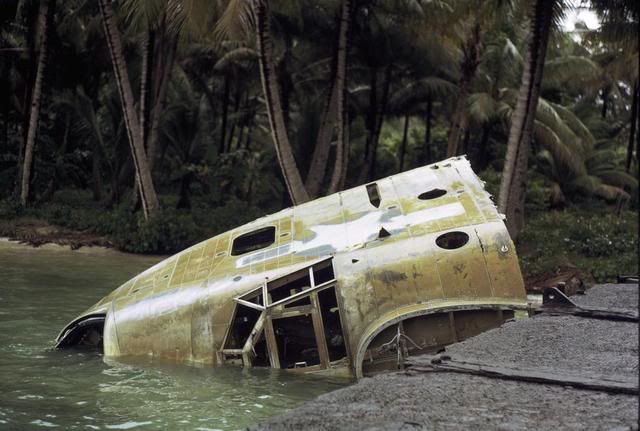
Photo by John Voss
DATE: 21 Sept. 1946
LOCATION: NAS Truk
UNIT: VP-32
OPERATING FROM: NAB Tanapag, Saipan
AIRCRAFT: PBM-5E BuNo 84652
PURPOSE: Typhoon Evacuation
MANUVER OR ALTITUDE OF MANUVER: Taxiing
PILOT: Pew, Lelie A. Cdr. USN
INJURIES: None
NAME AND RANK OF OTHER PERSONELL:
Lenz, Clifford A. Lt. Cdr. USN
Fleming, Douglas R. Ens. USNR
Wheeler, Wm. M. ACMM USN
Relton, Joseph L. AMFAC1 USN
Tomassi, Daniel, AOMAC1 USN
Oglesby, John T. ACMM, USN
& Additional crew members
DAMAGE DESCRIPTION & REMARKS:
Keel bent and skin rupt. bet. frames 28 and 29. 12 inch rip in skin on stbd. Side of hull 18 in. above keel bet. frame 18-20
CLASIFICATION OF ACCEDENT CAUSE:
P.E. Judgment or technique
SECIFIC ERRORS:
The inexperience and poor judgment of coxswain of LCVP who attempted to tow plane around crane barge to buoy was responsible for damage to wing tip and float. If coxswain had had proper appreciation for sea and wind conditions he would have kept plane clear of this obstruction. Pilot should have remained aboard aircraft until all precautions had been complied with.
CHECK-OFF ITEMS:
Taxiing of aircraft was done under conditions of darkness, rough water, and high winds. The seadrome at NAS Truk is not equipped for night operations, and reefs and other obstructions are not lighted.
ANALYSIS:
1750 plane landed at Truk under weather conditions set forth above just prior to sunset and proceeded to taxi to the west ramp as directed by the tower with the intention of securing to the ramp buoy for the night. About 1930 pilot was informed by tower that buoy had (been) carried away. In the meantime the pilot had been attempting to sail the plane downwind to the approx. location of the buoy using the headlights of a jeep on the ramp as a reference aided by the use of an Aldis lamp in the after station. On one attempt at the buoy the plane struck a reef just south of the ramp causing slow seepage of water but no identifiable damage. 2000 a boat came to lead the plane around to the vicinity of the south ramp where it was planned to moor to a buoy close in shore just east of a large crane barge. Upon returning into the wind in order to line up with the buoy, the plane went aground on a sand bar but weather cocked around and floated free without damage. 2030 secured to buoy. Immediately after making buoy and before cutting engines pilot was by personnel of crane barge that buoy was improperly moored so he cast off and secured the plane by two lines to the crash barge which was anchored just east of the south ramp. 0(??)0 pilot went ashore leaving instructions to navigator to cast off and make buoy in case of a wind shift to the south, it having been determined that the aforementioned buoy was properly anchored. About 0330 the wind commenced backing towards the south swinging the stern of the plane toward the beach over a reef. The navigator attempted to have the plane moved to the buoy assisted by personnel of the crane barge but before a line could be passed from the plane to the buoy, the hull near the after step struck a reef and the plane commenced shipping water at a fast rate. Flooding was controlled by plugging the hole with putty and bailing and the plane was pulled off the reef closer astern of the crane barge, After daylight directions were given to have the plane towed by LCVP clear of barge and upwind of buoy and thence to the ramp buoy for beaching. In attempting to tow the plane the coxswain lost control and the plane drifted toward the barge and the starboard wing tip and float struck the crane falls causing damage necessitating a changing of theses parts. The co-pilot who was in charge of the plane states that did not elect to start his engines for fear of damaging the patch in the hull in case use of excessive power became necessary in close quarters. The plane was then towed clear of the barge and beached without further incident.
LOC. REC:
Proper lighting of seadrome at NAS Truk with ample marking of reefs and other obstructions. Intensified instruction of boat crews concerned with seaplane operations. Adequate facilities for checking wind velocity.
GEN. REC:
Due regard for conditions of terminal and alternate destinations as regards weather and facilities should be given in making the decision to evacuate planes on short notice during emergency conditions.
CO:
Lack of communications between seaplane ramp and control tower at the land field prevented tower from passing correct information as to condition of buoys. Pilot should have remained with aircraft until adequately secured. Squadron instructions have been issued for Patrol Plane Commanders to remain with the aircraft in conditions of similar nature.
Unfortunately, I am not nearly as certain this is the actual identity of the second aircraft in question. I do however feel it is the likely candidate.
I find it interesting that neither report indicates that the aircraft was ultimately written off and abandoned. The report for the second aircraft, PBM-5E BuNo 84652, does include a hand written notation, that while almost entirely unreadable, appears to include the word sinking.
Hopefully this post has not been too long-winded.
I would greatly appreciate any information that could be provided to back up, elaborate on, or contradict my findings. Once I am satisfied with the validity of my information, it will be submitted to The Chuuk State Historic Preservation Office to aid them in their efforts to document and preserve the numerous historic sites around the islands. This information will also be distributed to other organizations that may find it useful.
Thank you for your assistance in this endeavor.
I feel I have finally pinned down the identity the particular PBM that I photographed, as well as the events that lead to its ultimate fate. For your review I have a transcription (for ease of reading) of the incident report for PBM-5E BuNo 84654. Some information that was unreadable or deemed irrelevant has been omitted.
DATE: 20 September 1946
HOUR: 1755
LOCATION: Moen Island. Truk Atoll
UNIT: Patrol Squadron 32
OPERATING FROM: NAB Tanapag, Saipan
CHAIN OF COMAND: Co, FAW-18
AIRCRAFT: PBM-5E BuNo 84654
PURPOSE: Typhoon Evacuation
MANUVER OR ALTITUDE OF MANUVER: Landing
PILOT: Craven, Tunis A. M. Lt. (jg), USNR – Patrol Sq.32
INJURIES: None
NAME AND RANK OF OTHER PERSONELL:
Harris, Winfred M. Lt. (jg), USNR
Ora, Charles J. Ens. USNR
Wheeler, Laurence M. L.T. (jg), USN
Corson, Harold T. CMMTACA (?), USN
6 Addl. crewmen
DAMAGE DESCRIPTION & REMARKS:
Stbd. Float sheared off and starboard rudder torn loose and bent. Hull severely ruptured, port wing float carried away, port main spar twisted.
CLASIFICATION OF ACCEDENT CAUSE:
P.E. Judgment or technique
SPECIFIC ERRORS;
1. Faster reaction on the yoke to maintain proper attitude after first impact with the water might have reduced the height of the bounce and the falling off on the starboard wing.
CHECK-OFF ITEMS:
Truck was on the fringe of a typhoon when our plane arrived there. The ceiling was 1000 ft. visibility 5 miles, wind 25-30 kts. from (280?) degrees true with strong gusts. The sea was extremely rough with waves 10-15 feet in height. The seaplane area lacks a sufficient number of adequately sheltered mooring buoys; reefs are not marked; the area is not lighted and is unsafe for taxiing after dark.
ANALYSIS:
Plane arrived over Moen Island, Truk Atoll, 1748. 1750-Pilot made a pass into the wind over the prospective landing area at 500 ft; made a right hand turn to the downwind leg, and continued the landing approach with right hand traffic. The pilot lowered flaps to 20 degrees on the downwind leg. He entered the final at 300 ft and increased flaps to 30 degrees with 95 knots airspeed. At approx. 100 ft with 2600 RPM and 23-24 inches manifold pressure the pilot started breaking the glide for a power stall landing. Just above the water the plane ballooned slightly and power was reduced to approx. 21-22 inches. This reduction of power smoothed out the approach and the power stall landing procedure was continued. Just above the waves with approx. 68 knots airspeed, the pilot cut his power and stalled the plane on, or just beyond the crest of a wave. The procedure to this point was in accordance with Squadron doctrine for rough water landings. The plane rode down the crest of the first wave and in riding up the second wave planed off the water and went approx. 20 ft. into the air. The pilot and co-pilot applied forward pressure on the yoke to lessen the height of the bounce, and then back pressure to ease the second impact. At the top of the bounce the plane fell off on the starboard wing. Full left rudder and aileron were applied but the plane still struck the water with the starboard float and hull making contact at the same time. The starboard wing float sheared off, and the starboard rudder was torn and jammed. Under normal wind and sea conditions further damage would not have occurred, but under conditions of darkness, gale winds, and rough seas combined with the lack of reference lights, and inadequate boat facilities, it was impossible to taxi the plane into a sheltered area. After the accident the pilot used every possible precaution to get the plane into a sheltered position, but was unsuccessful, and ultimately the plane drifted on a reef just off Moen Island and was abandoned by the crew without injury to personnel. The most extensive damage including the loss of the port float, the twisting of the port main wing spar, and serious rupturing of the hull resulted from the severe pounding of the plane against the reef.
SPEC. EQUIP:
Emergency equipment functioned satisfactorily.
LOC. REC:
Recommend more intensified training in rough water and open sea landings. Installation of more adequate seaplane facilities and the proper marking of reefs at Truk.
CO:
The weather at Truk was worse than forecasted. The pilot is considered to have used proper technique in rough water landing. The combination of lack of rudder control, necessity of keeping the port float down in extremely rough water, darkness and the lack of communication with boats presented a problem which the pilot could not control in running aground.
I am 99% sure that PBM-5E BuNo 84654 is the identity of the Mariner wreck I photographed on Weno (Moen).
I have also been working on the identity of the PBM photographed by Mr. Voss. I did end up getting in contact with John Voss (who I just discovered is now a WIX member), and with information provided by him I feel a likely candidate for the aircraft in his photo is PBM-5E BuNo 84652. Again, I have transcribed the incident report and some information has been omitted where unreadable or deemed irrelevant.
Photo by John Voss
DATE: 21 Sept. 1946
LOCATION: NAS Truk
UNIT: VP-32
OPERATING FROM: NAB Tanapag, Saipan
AIRCRAFT: PBM-5E BuNo 84652
PURPOSE: Typhoon Evacuation
MANUVER OR ALTITUDE OF MANUVER: Taxiing
PILOT: Pew, Lelie A. Cdr. USN
INJURIES: None
NAME AND RANK OF OTHER PERSONELL:
Lenz, Clifford A. Lt. Cdr. USN
Fleming, Douglas R. Ens. USNR
Wheeler, Wm. M. ACMM USN
Relton, Joseph L. AMFAC1 USN
Tomassi, Daniel, AOMAC1 USN
Oglesby, John T. ACMM, USN
& Additional crew members
DAMAGE DESCRIPTION & REMARKS:
Keel bent and skin rupt. bet. frames 28 and 29. 12 inch rip in skin on stbd. Side of hull 18 in. above keel bet. frame 18-20
CLASIFICATION OF ACCEDENT CAUSE:
P.E. Judgment or technique
SECIFIC ERRORS:
The inexperience and poor judgment of coxswain of LCVP who attempted to tow plane around crane barge to buoy was responsible for damage to wing tip and float. If coxswain had had proper appreciation for sea and wind conditions he would have kept plane clear of this obstruction. Pilot should have remained aboard aircraft until all precautions had been complied with.
CHECK-OFF ITEMS:
Taxiing of aircraft was done under conditions of darkness, rough water, and high winds. The seadrome at NAS Truk is not equipped for night operations, and reefs and other obstructions are not lighted.
ANALYSIS:
1750 plane landed at Truk under weather conditions set forth above just prior to sunset and proceeded to taxi to the west ramp as directed by the tower with the intention of securing to the ramp buoy for the night. About 1930 pilot was informed by tower that buoy had (been) carried away. In the meantime the pilot had been attempting to sail the plane downwind to the approx. location of the buoy using the headlights of a jeep on the ramp as a reference aided by the use of an Aldis lamp in the after station. On one attempt at the buoy the plane struck a reef just south of the ramp causing slow seepage of water but no identifiable damage. 2000 a boat came to lead the plane around to the vicinity of the south ramp where it was planned to moor to a buoy close in shore just east of a large crane barge. Upon returning into the wind in order to line up with the buoy, the plane went aground on a sand bar but weather cocked around and floated free without damage. 2030 secured to buoy. Immediately after making buoy and before cutting engines pilot was by personnel of crane barge that buoy was improperly moored so he cast off and secured the plane by two lines to the crash barge which was anchored just east of the south ramp. 0(??)0 pilot went ashore leaving instructions to navigator to cast off and make buoy in case of a wind shift to the south, it having been determined that the aforementioned buoy was properly anchored. About 0330 the wind commenced backing towards the south swinging the stern of the plane toward the beach over a reef. The navigator attempted to have the plane moved to the buoy assisted by personnel of the crane barge but before a line could be passed from the plane to the buoy, the hull near the after step struck a reef and the plane commenced shipping water at a fast rate. Flooding was controlled by plugging the hole with putty and bailing and the plane was pulled off the reef closer astern of the crane barge, After daylight directions were given to have the plane towed by LCVP clear of barge and upwind of buoy and thence to the ramp buoy for beaching. In attempting to tow the plane the coxswain lost control and the plane drifted toward the barge and the starboard wing tip and float struck the crane falls causing damage necessitating a changing of theses parts. The co-pilot who was in charge of the plane states that did not elect to start his engines for fear of damaging the patch in the hull in case use of excessive power became necessary in close quarters. The plane was then towed clear of the barge and beached without further incident.
LOC. REC:
Proper lighting of seadrome at NAS Truk with ample marking of reefs and other obstructions. Intensified instruction of boat crews concerned with seaplane operations. Adequate facilities for checking wind velocity.
GEN. REC:
Due regard for conditions of terminal and alternate destinations as regards weather and facilities should be given in making the decision to evacuate planes on short notice during emergency conditions.
CO:
Lack of communications between seaplane ramp and control tower at the land field prevented tower from passing correct information as to condition of buoys. Pilot should have remained with aircraft until adequately secured. Squadron instructions have been issued for Patrol Plane Commanders to remain with the aircraft in conditions of similar nature.
Unfortunately, I am not nearly as certain this is the actual identity of the second aircraft in question. I do however feel it is the likely candidate.
I find it interesting that neither report indicates that the aircraft was ultimately written off and abandoned. The report for the second aircraft, PBM-5E BuNo 84652, does include a hand written notation, that while almost entirely unreadable, appears to include the word sinking.
Hopefully this post has not been too long-winded.
I would greatly appreciate any information that could be provided to back up, elaborate on, or contradict my findings. Once I am satisfied with the validity of my information, it will be submitted to The Chuuk State Historic Preservation Office to aid them in their efforts to document and preserve the numerous historic sites around the islands. This information will also be distributed to other organizations that may find it useful.
Thank you for your assistance in this endeavor.
Sun Sep 28, 2008 12:26 am
Too much all at once? 
Mystery PBM Wrecks at Truk
Sun Sep 28, 2008 7:00 pm
Curtis:
After a lot of reserach it appears that you finally solved the mystery of the PBM's on Truk! Congratulations are in order. When I was there the locals told me of the 'other' wreck but the wherabouts was vague. Everyone I talked to seemed to agree about the post WWII typhoon causing the carnage but they informed me that they were USCG A/C. That didn't make sense as the wreck I photographed the PBM was configured with the turret in the nose which seemed inconsistant with a USCG ship. During the naval administation of the Trust Territory VR-21 operated PBM-5R's through the territory that also had their nose turrets removed. So ithse wrecks have alway been a mystery. Glad you solved it!!
John Voss