Warbird Information Exchange

DISCLAIMER: The views expressed on this site are the responsibility of the poster and do not reflect the views of the management.
It is currently Fri Jul 11, 2025 11:58 pm

All times are UTC - 5 hours


Classic Wings Magazine WWII Naval Aviation Research Pacific Luftwaffe Resource Center
When Hollywood Ruled The Skies - Volumes 1 through 4 by Bruce Oriss


Post new topic Reply to topic  [ 43 posts ]  Go to page 1, 2, 3  Next
Author Message
PostPosted: Wed Jul 21, 2010 1:43 pm 
Offline
User avatar

Joined: Sat May 01, 2004 8:34 am
Posts: 519
Location: Oxfordshire UK
After last years trip around the Ypres Salient, this year along with 3 good friends I again made the short hop across the channel on Flying Legends weekend to pay my respects to some real Legends.

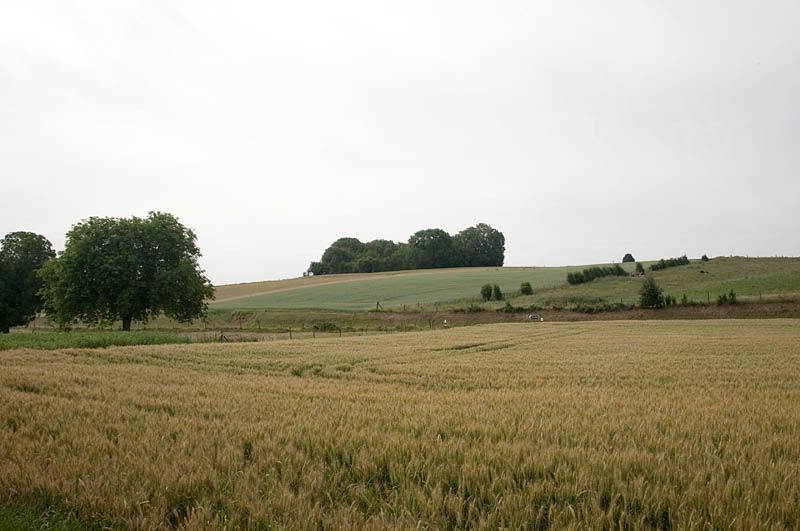
An hour and a half drive from Calais the Somme Battlefields were very different from the Salient. Instead of being flat below sea level, they are quite hilly and mostly chalky. Like the Salient they are rural in nature.
The Somme has been fought over for years, there is a spot just outside Delville Woods where Julius Caesar is reported to have addressed his troops before giving the Gauls a good kicking. Later the Prussians invaded then of course there was the Great War. Afterwards the area of course came under the jackboots of the Nazis before liberation in 1944.

The Cemeteries’ themselves differ from those on Passchendaele because they are mostly what is known as “concentration” cemeteries. This means that they were created from scratch after the war when the battlefields were cleared, there are several notable exceptions to this as we will see later. Those on the Salient are similar but more often the concentration element is centred around an original cemetery. This does not detract from them one iota, they are still very moving places to visit. One major point that both the Somme and The Salient have in common is that the Germans nearly always held the high ground. In the case of the Somme they had held it for 2 years and because of the chalky ground they had dug in and created quite considerable fortifications.

Our plan was to tour the Battlefields from North to South.

Day 1
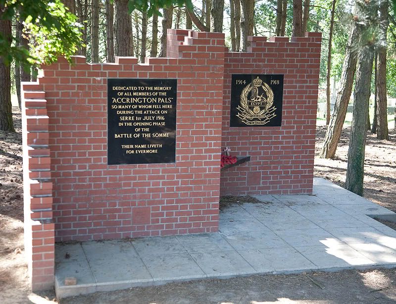
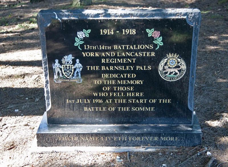
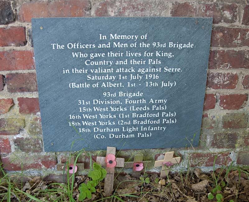
Our journey through the battlefields begins in the North at Serre. Here we visited Sheffield Park which is centred on the site of 4 small Copses, Matthew , Mark, Luke and John which today are now one wood. In the wood are several memorials. The first of which is to The Accrington Pals who attacked here on the 1st July 1916.
Image

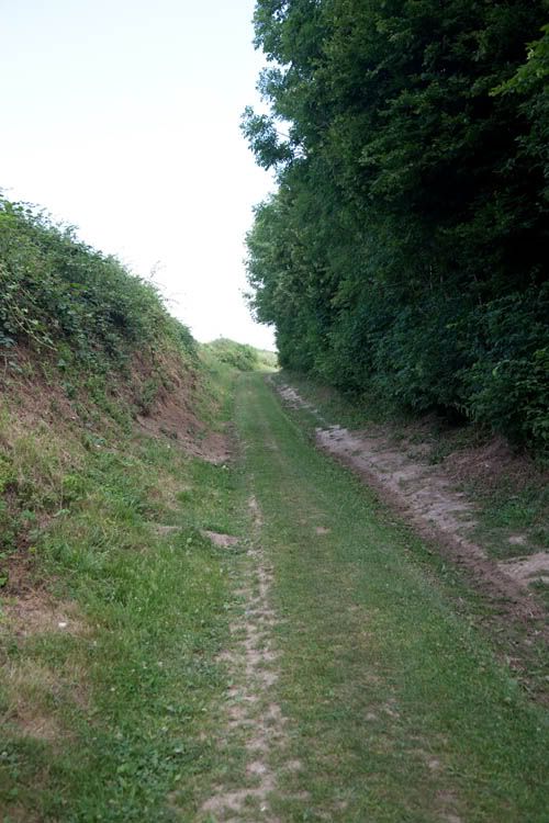
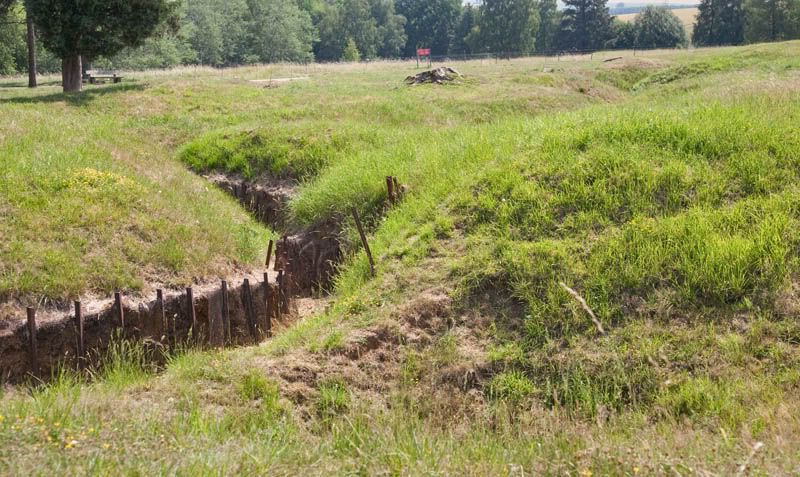
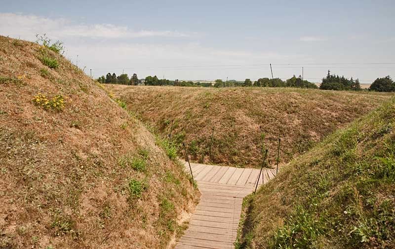
At the edge of the wood are the remains of the trench the 31st Division attacked from
Image

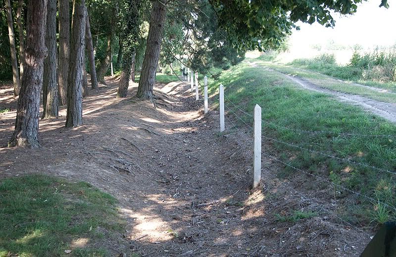
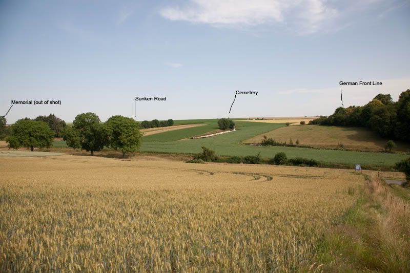
The view from the Trench towards the front line. The cemetery beyond the farmer is Queens Cemetery which is situated roughly mid way in No Mans Land. You will notice that the attack took place up hill, this will become a common theme.
Image

A couple of the other memorials in Sheffield Park.
Image

Image

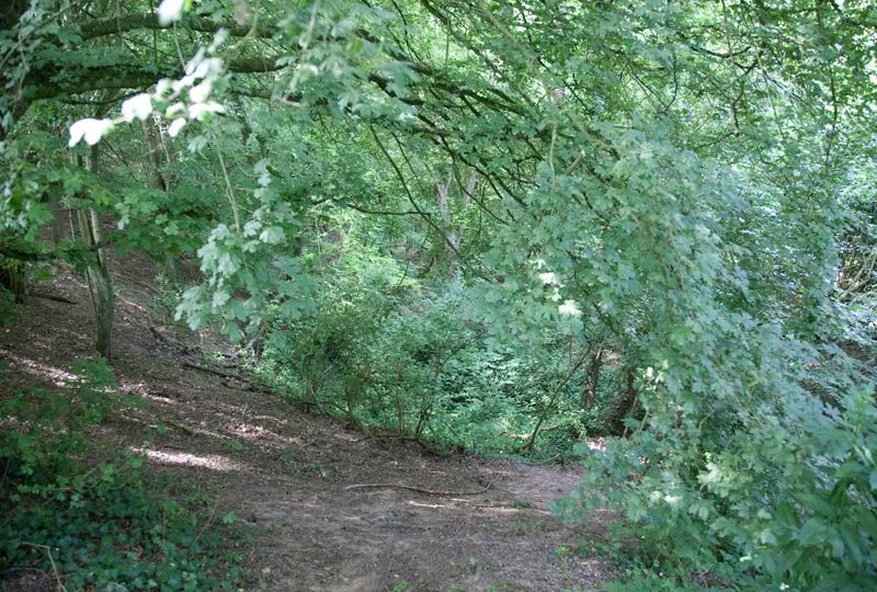
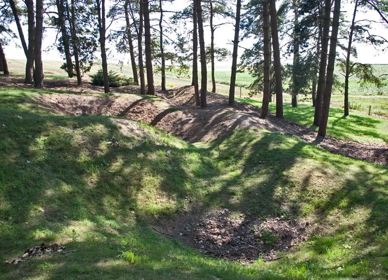
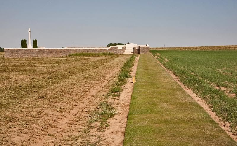
Heading through the park towards Railway Hollow Cemetery the land is as it was in 1918, with remains of trenches pock marked with shell holes.
Image

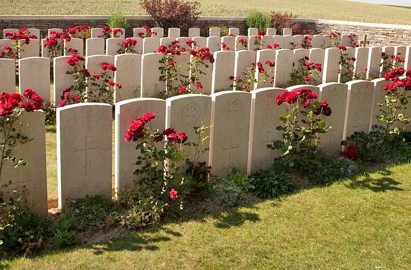
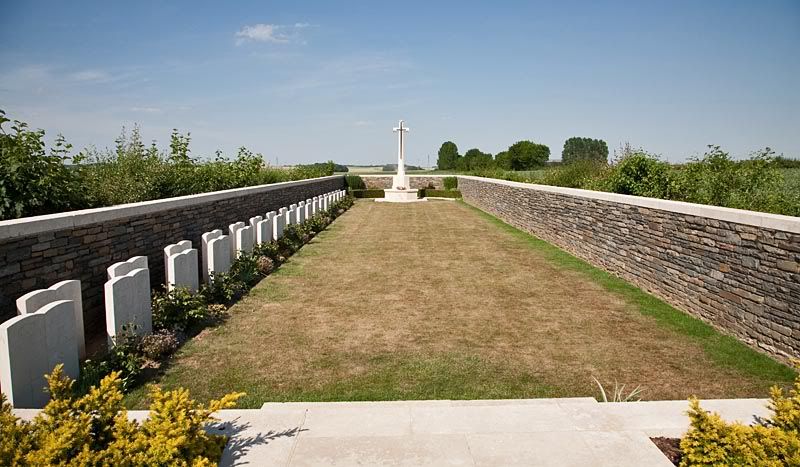
The Cemetery contains 107 UK burials and is on the line of the old military railway which ran through here.
Image

Image

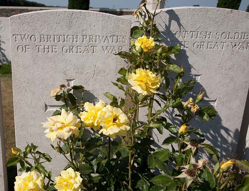
About 100 yards north of Sheffield Park is Like Copse Cemetery. A small cemetery of 72 burials of Sheffield City Battalion men. Including brothers L Cpl F and Pte W Gunstone, this marks the furthest north of the attacks on July 1st 1916. The men are buried in 1 long grave (a trench?) with the headstones staggered so that each man has his own.
Image

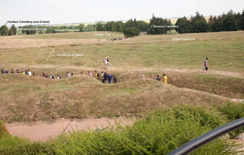
If you turn and look the other way, its just possible to make out the line of the trench system in the bean field beyond. This view looks back towards Sheffield Park and I have marked the probable trench line on it.
Image

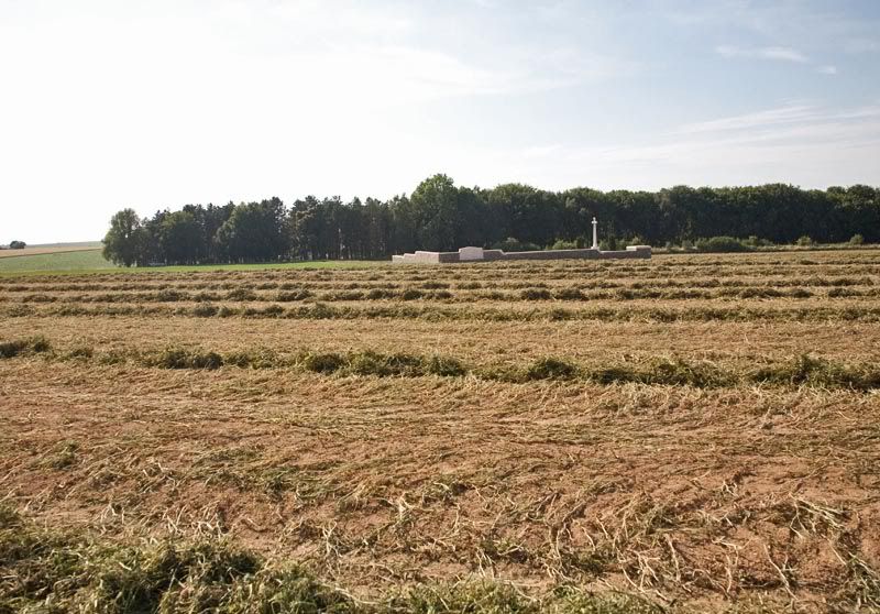
Up the hill as we saw earlier lies the Queens Cemetery. It contains 311 graves many of which are Accrington Pals a large proportion of which are unidentified as this part of the battlefield was fought over between July and November with little or no chance made to clear it of bodies.
Image
Image
Image

Walking up the hill about as far again and you come to the German Front line, looking back gives you and idea of what the Pals were up against. One machine gun could have/did mow them down.
Image

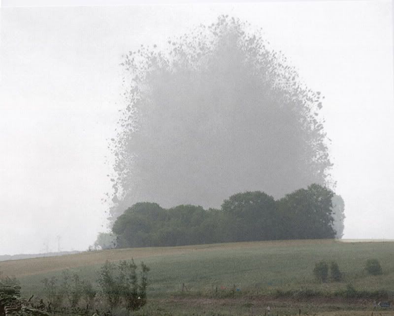
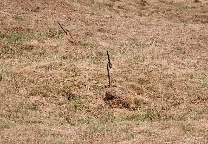
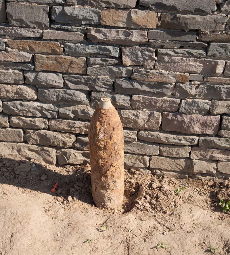
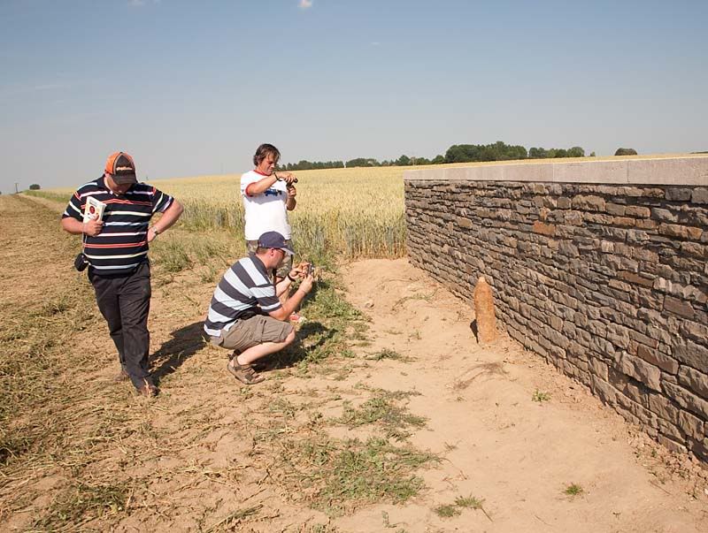
The final Cemetery in this locality is Serre Road Number 3. Here we found some of the Iron Harvest waiting to be collected, in this case and Artillery Shell that doesn’t appear to have been fired, or was a dud. We didn’t touch it, but some got closer than others!
Image
Image

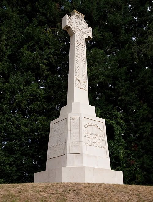
Heading back towards the main road, on the corner of a farm building is a memorial to the lost.
Image

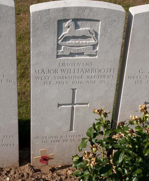
Back on the main road we stopped at Serre Road Cemetery Number 1. Here 71.6% of the 2412 burials are unidentified, one of the highest proportions on the Somme. The original burials are to the rear with the remainder being concentration after the war.
Image

Image

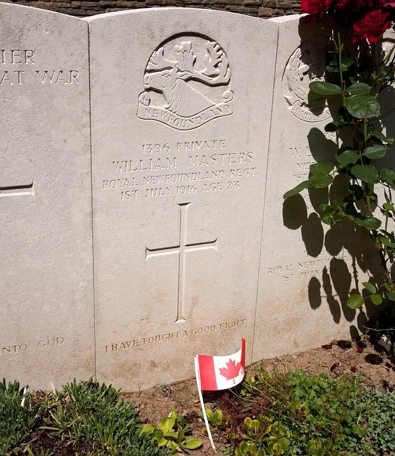
An interesting burial here is Lt Major William Booth (Major was his Christian name) who was a Yorkshire County Cricketer who twice played for England. He was killed by a shell on July 1st 1916.
Image

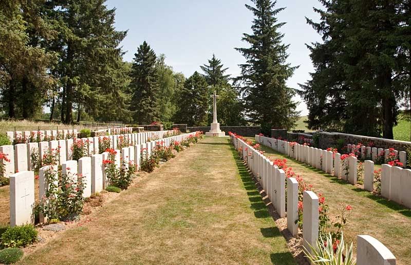
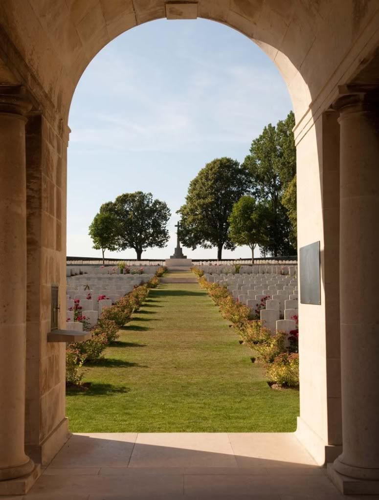
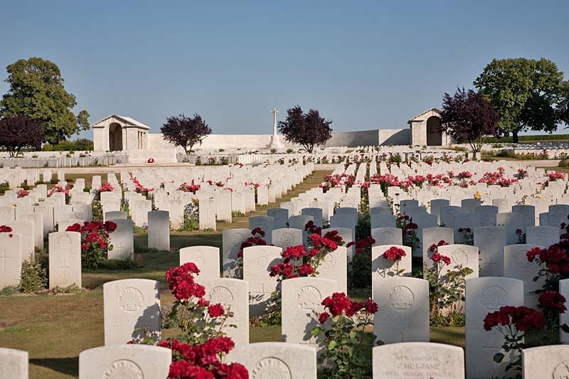
Serre Road Number 2 Cemetery just up the road is the largest on the Somme
Image

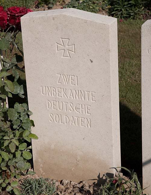
An unidentified German
Image

During WW2 the CWGC gardener (an Englishman) used his shed at the rear of the cemetery to hide downed aircrew. By the wars end Mr Ben Leach had helped 32 airmen escape the clutches of the Nazis.
The next day we donned our walking boots to walk the front line.

_________________
MY BLOG and other ramblings This is where most of my photos will appear in future.

The Shuttleworth Collection Facebook Page


Top
 Profile  
 
PostPosted: Wed Jul 21, 2010 2:12 pm 
Offline
Long Time Member
Long Time Member
User avatar

Joined: Mon May 03, 2004 5:42 pm
Posts: 5749
Location: Waukegan,Illinois
One day I would like to make a trip to France and check out WW1 stuff. That stuff fascinates me. Recently on the Military Ch they had a show called Digging up the Trenches. They found an incredible amount of relics inculding human remains buried just a few feet down in an excavated trench about 200' long. To realize the front line trenches stretched over 400 miles is mind bogling. Then there were supply trenches and additional trenches to hold reserves. Thats alot of dirt moved. Thanks for posting those. They are great.

_________________
Ain't no sunshine when she's gone!


Top
 Profile  
 
PostPosted: Wed Jul 21, 2010 3:44 pm 
Offline
User avatar

Joined: Sat May 01, 2004 8:34 am
Posts: 519
Location: Oxfordshire UK
Day 2, walking the front line.
Today we walked from our base at Avril Williams superb B&B at Auchonvillers (or Ocean Villas as the Tommies called it) towards Beaumont Hamel. At the side of the road the Poppy and Cornflower grow together. The British and French symbols of remembrance in their natural environment.

Image

A short walk brings us to an interesting section of the old opposing trenches and the site of one of the most iconic images of the War. Just outside the village of Beaumont Hamel, on top of the ridgeline on the southern side of the road was the Hawthorn Ridge Redoubt. Ten minutes before Zero Hour on 1st July 1916 a mine which had been tunnelled under the Redoubt was exploded. It consisted of over 18 Tons of high explosive. Its deliberate early detonation gave the game away.

The site of the mine is the copse of trees in the middle of the shot
Image
There were a number of mines along the front line, the plan being to explode them at Zero Hour (07.30am) and for troops to rush them and capture the rim thus giving cover for further attacks on enemy lines. The decision to explode this one was made because it was so large that they thought the ground would need time to settle. The 10 minutes notice allowed the Germans to capture the rim and as the men of the 29th Division were attacking up hill (once again) they became easy pickings when the moved 10 minutes later. They managed to gain a foothold on the craters edge and this was the only success on their front, sadly even this was abandoned later in the day.

This is an overlay of the mine as it is today with an original photo. My modern image was taken as close as possible to the original. Literally standing in the footsteps of history.

Image

Opposite the crater on the opposite ridge line at the entrance to the famous Sunken Road (more of this in a bit) is the 8th Argyll and Sutherland Highlanders Memorial. This marks the spot where this unit attacked so successfully in November of 1916. It is located roughly at the mid point of the July 1916 No Mans Land.
Image

The Sunken Road is to the left of this memorial. Walking up it the remains of trenches dugouts and tunnels can clearly be seen. The front line runs parallel to this road.
This is the view looking up (away from the front line)
Image

This the view down.
Image

An interesting find was this old railway track being used as a fence post. Clearly a remnant of a violent past.
Image

The Beaumont Hamel British Cemetery lies at the mid point of no mans land, it contains 176 graves nearly half of them unidentified.
Image

From this point we walked up the hill towards the crater, this is the view back over the battlefield
Image

The view into the crater. Its risky to go down into it, mainly because the sides are so steep. Its two craters as another mine was exploded here in November. It is do-able but we had lots to do and I certainly didn’t fancy being stuck in a mine crater!
Image

Just beyond the crater lies Hawthorn Ridge Cemetery Number 1. It contains 153 burials from 1916,17 and 18 and was created during a lull in the fighting in 1917. The bodies of the dead from 1916 would quite possibly have been removed from the battlefield where they died, others would have come from makeshift graves. 42 of the men here are from the 16th Middlesex Battalion which was a New Army Battalion raised from Public Schoolboys..
Image
Our next destination was the famous Newfoundland Memorial Park. But before we set off the French Air Force paid us a visit.
Image

More soon.

_________________
MY BLOG and other ramblings This is where most of my photos will appear in future.

The Shuttleworth Collection Facebook Page


Top
 Profile  
 
PostPosted: Wed Jul 21, 2010 5:06 pm 
Offline
Long Time Member
Long Time Member
User avatar

Joined: Mon May 03, 2004 5:42 pm
Posts: 5749
Location: Waukegan,Illinois
Another great set of photos along with informative descriptions! Keep it coming .

_________________
Ain't no sunshine when she's gone!


Top
 Profile  
 
PostPosted: Wed Jul 21, 2010 7:00 pm 
Offline
User avatar

Joined: Sun Dec 05, 2004 3:22 am
Posts: 422
Location: Melbourne
Very interesting, thanks!


Top
 Profile  
 
PostPosted: Wed Jul 21, 2010 8:01 pm 
Offline
1000+ Posts!
1000+ Posts!
User avatar

Joined: Sun Feb 18, 2007 12:39 pm
Posts: 1817
Location: Irving, Texas
Keep the posts coming!

It reminds me of Vicksburg, Mississippi....


Top
 Profile  
 
PostPosted: Wed Jul 21, 2010 11:45 pm 
Offline
User avatar

Joined: Thu Mar 04, 2010 10:48 pm
Posts: 937
Location: Westchester New York
Rather fitting I started reading this while I'm watching "All Quiet on the Western Front" Lovley photos with great narration. Thank you for sharing.

Does this battlefield remind anyone else of ANTIETAM in Sharpsburg, MD?

_________________
Andrew King
Air Museum Director with no Museum to Direct
Open to Suggestions


Top
 Profile  
 
PostPosted: Thu Jul 22, 2010 7:00 am 
Offline
User avatar

Joined: Thu Feb 28, 2008 6:46 am
Posts: 267
Location: Indianapolis, Indiana
Thanks very much for posting these photos. Excellent descriptions, too.

This is a trip I've long wanted to make myself--walking the old Western Front to see what is there to be seen.

A well done post, reminiscent of a book I recently read:

Back to the Front

Stephen O'Shea is the author. Fascinating stuff, like this post.

_________________
IndyJen

------------------------------

Support "Hot Stuff"
Lockheed PV-2 Harpoon of the
American Military Heritage Foundation
http://www.amhf.org


Top
 Profile  
 
PostPosted: Thu Jul 22, 2010 7:34 am 
Offline
Account Suspended
User avatar

Joined: Wed Nov 14, 2007 3:06 pm
Posts: 2713
Brilliant!!!!

Cheers

_________________
S.


Top
 Profile  
 
PostPosted: Thu Jul 22, 2010 3:10 pm 
Offline
User avatar

Joined: Sat May 01, 2004 8:34 am
Posts: 519
Location: Oxfordshire UK
Newfoundland Memorial Park.

Continuing on across the fields, making sure to keep to the tractor tracks so as not to damage the crop and avoid any, erm, Ordnance that may be lying around (if the tractor doesn’t go bang we should in theory be safe) we arrived at the rear entrance to Newfoundland Memorial Park, on of the most emotional and memorable stops of the whole trip. Purchased by the then Newfoundland Government after the war, it contains the complete trench systems of July-Novermber1916; 3 Cemeteries, and 3 memorials. It stands in memory of the Newfoundland Volunteer Battalion which launched its ill fated attack an hour after zero hour on 1st July 1916.

The first memorial we came to was the 51st Highland Division Memorial standing on the German front line.
Image

Nearby is the unique Hunters Cemetery. Containing 46 highlanders who were buried in a shell hole, its headstones are set in a circular pattern around the cross of sacrifice.
Image

Behind this and the memorial lie the remains of the old German front line.
Image

Next along the path is Hawthorn Ridge Cemetery number 2. Containing the graves of 214 men who perished on the 1st July 1916,
Image
including Private William Masters of the Newfoundland Regiment. Most of not all of the Newfoundland Graves have the Canadian flag on them.
Image

The first view of the Newfoundland Memorial is gained through an alleyway of trees.
Image

Before we got there we turned left to walk across the Battlefield.
Image
The old trenches are untouched since the war apart from the grass. Indeed just after the war there was even the wreckage of a tank visible but this is long since gone. The barb wire spiral posts are still there though.
Image

As we walk down the hill we walked along a metalled path (for safety) but the ground still bears the marks of the shelling.
Image

Onwards past the Danger Tree which marks the furthest the Newfoundlanders got in the battle (nowhere near the front line)
Image
At the bottom of the Hill is the Y Ravine Cemetery. Made in 1916 and containing the bodies of 366 men. It was here that I very privately placed a cross on the grave of a Newfie and contemplated the sacrifice they made. It wasn’t their fight (they weren’t part of Canada at that point) but they came anyway. And didn’t even make the front line on the opening day. The German front line is a few years beyond the rear wall.
.Image

Retracing our steps we made it to the memorial. It is surrounded by Trenches, many of which can be walked along. In 1916 they were some 2 ft deeper and had fire steps cut into the edges but they are a close as we can now get to how they were.
Image
The view of the enemy wasn’t that good.
Image

The view from the memorial gives an overall impression of the lie of the land.
Image

The Newfoundlanders were attacking from behind us. They were in the second wave and so were in a trench to the rear, their way was blocked by the dead and wounded so, rather than delay and clear way they went of the top from a second line trench. The German machine gunners simply cut them down, mostly before they made the front line. Indeed many of the German Divisional histories make no mention of the Newfies because they never came across them, they were all dead behind their own lines.
The memorial is one of four on the Western Front in the form of a Caribou calling for its young.
Image

I noticed it was floodlit and asked one of the park rangers if it was possible to take pictures after dark. On being told that it was encouraged we went back after dark. It was breathtaking.
Image

Image

In order to get a better view, I walked into one of the trenches and set up my tripod. By this time I was on my own and we had split up to all get different shots. There were at least 4 Tawny Owls in the woods calling to each other and the local farmer was shooting rabbits. One of my companions was wandering around the woods using a flash on his camera
It was then that the lights went out!
Image

That was the longest 20 seconds of my life.

Day 3 next and a sad discovery.

_________________
MY BLOG and other ramblings This is where most of my photos will appear in future.

The Shuttleworth Collection Facebook Page


Top
 Profile  
 
PostPosted: Thu Jul 22, 2010 9:00 pm 
Offline
Long Time Member
Long Time Member
User avatar

Joined: Mon May 03, 2004 5:42 pm
Posts: 5749
Location: Waukegan,Illinois
More great photos! The remains of the trenches and the barbed wire posts are most interesting. Not sure what to expect with your "sad discovery".

_________________
Ain't no sunshine when she's gone!


Top
 Profile  
 
PostPosted: Fri Jul 23, 2010 12:00 am 
Offline
Long Time Member
Long Time Member

Joined: Sat Dec 22, 2007 12:36 am
Posts: 7961
Location: Mt. Vernon, WA.
Did you have the feeling you were being 'observed'? I know every time we took someone out to Chalmette in St. Bernard (Jackson's battle of New Orleans battlefield) I always felt that we were being watched by the long time 'occupants' who struggled over that piece of ground so long ago. I'm sorry now that I never made the effort to visit Gettysburg or Antietam when I lived so much closer.

_________________
Don't make me go get my flying monkeys-


Top
 Profile  
 
PostPosted: Fri Jul 23, 2010 11:59 am 
Offline
1000+ Posts!
1000+ Posts!

Joined: Fri May 25, 2007 4:50 pm
Posts: 1028
Thank you for sharing your photographs and story. This is one of the best posts ever on Wix or anywhere else for that matter. I hope I get the chance to visit these places in person one day.

_________________
Always looking for WW2 Half-Tracks and Parts.


Top
 Profile  
 
PostPosted: Fri Jul 23, 2010 12:23 pm 
Offline
3000+ Post Club
3000+ Post Club
User avatar

Joined: Fri Apr 30, 2004 2:29 pm
Posts: 4527
Location: Dallas, TX
I have two old copies (different versions) of American Battle Fields in Europe, published after the war (before WW2) as a sort of "tour guide" book to the World War 1 battlefields and have long thought it would be good to go see them some time.

Ryan

_________________
Aerial Photographer with Red Wing Aerial Photography currently based at KRBD and tailwheel CFI.
Websites: Texas Tailwheel Flight Training, DoolittleRaid.com and Lbirds.com.

The horse is prepared against the day of battle: but safety is of the LORD. - Prov. 21:31 - Train, Practice, Trust.


Last edited by RyanShort1 on Fri Jul 23, 2010 12:40 pm, edited 1 time in total.

Top
 Profile  
 
PostPosted: Fri Jul 23, 2010 12:36 pm 
Offline

Joined: Tue Apr 15, 2008 12:43 pm
Posts: 145
Location: Wisconsin Rapids, WI
Wow awesome pictures. Thanks for sharing!

_________________
There are only two types of aircraft -- fighters and targets


Top
 Profile  
 
Display posts from previous:  Sort by  
Post new topic Reply to topic  [ 43 posts ]  Go to page 1, 2, 3  Next

All times are UTC - 5 hours


Who is online

Users browsing this forum: Google [Bot] and 44 guests


You cannot post new topics in this forum
You cannot reply to topics in this forum
You cannot edit your posts in this forum
You cannot delete your posts in this forum
You cannot post attachments in this forum

Search for:
Jump to:  
Powered by phpBB® Forum Software © phpBB Group