mrhenniger wrote:
I have a few follow-on questions to Roger's info. Maybe someone here knows the answers.
>New addition, at Stockton Airport at a Veterans Club house, there is a
>helo there, that I recall was an AH-1 Cobra
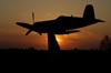
Helicopters are hard to pick out using Google Earth, especially the narrow AH-1. Do you suppost this is it?... 38 00 42.85 N 121 17 41.91 W
>> Merced Airport: Lockheed T-33
> Pole mounted at the airport entrance
Do you suppose this is it? 37 17 29.57 N 120 30 52.51 W It doesn't look too much like an airplane, but the resolution in this area is not good.
>> Amador Airport
> RF-86F-25-NA s/n 62-6416 ex JASDF - Veterans organization, don't
> remember which one
Just to confirm... this is NOT the one at the Estrella Warbird Museum? There is no AMVETS in Jackson, CA, where the Amador Airport is. Duncan Curtiss has two possibilities for this one...
#1 RF-86F Paso Robles, noted Jun98. This aircraft has the tail of F-86F 55-5019, other parts of F-86F 55-5082 and the forward fuselage of an RF-86F (thought to be 52-4758 [ex-JASDF 52-6401] or 52-5439 [ex-JASDF 62-6416]). Ex-China Lake.
#2 F-86F Jackson, Amador County Airport - presumably ex-China Lake.
Comments anyone?
Mike
Google Earth is nice, but it's not a bible.
Merced is a P-80, my earlier mistake calling it a T-33. Trust me on this, yes there is a P-80 in that spot, I saw it there last month and for the past 20 years.
37 17 29.57 N 120 30
50.74 W
Paso Robles (EWM) and Amador County Airport (Wendover Field) are probably 200 miles apart from each other.
Info directly off the plane: F-86F-25-NH, USAF 62-6416 (ex JASDF 562855)
38 22 36.66 N 120 47 47.16 W
Picture at Stockton Airport is a Cobra: 37 53 23.36 N 121 14 52.90 W
_________________
Roger Cain
www.sfahistory.org
http://groups.yahoo.com/group/Stearman/
We must limit politicians to two terms:
one in office and one in jail.